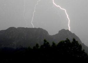
 After the tragic events in the Tatra Mountains in Poland on August 22, 2019, many people ask the question: could this have been avoided? After all, it was impossible to give an official warning, because as meteorology experts and notable on TV claimed, the expected rainfall and wind did not exceed the alarm limits (!). But were you sure that the competent services used all the information they had? Probably not…
Since 2003, there is a worldwide, social network for determining the position of atmospheric discharges in real time Blitzortung.org. Unfortunately, as is often the case, amateurs, working for free, overtake services and offices who have huge funds for the security of citizens.
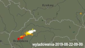
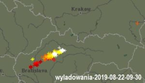
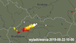
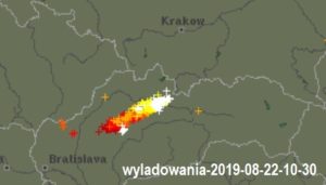
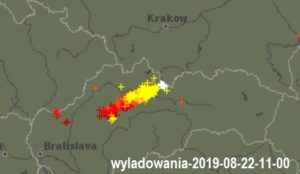
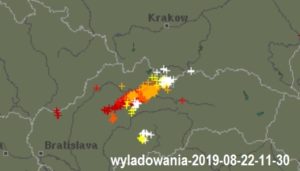
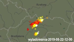
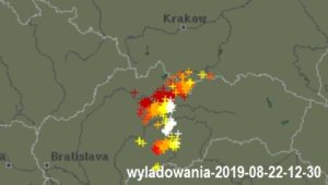
A brief overview of the maps from Blitzortung.org shows the dangerous situation with the naked eye: a strong front of lightning at a speed of about 50 km/h was moving from Bratislava direction in Czech Republic. From 9 am on this unlucky day you could see that he was heading towards Zakopane and the region of the Tatra Mountains in Poland, our tourist mecca (see the video).
If the relevant services used this information, then analysing this data by computer (or even manually from maps) could easily, through cell phone operators, knowing from the BTSs the area where their owners were, give warning in advance of the Tatra region in Poland already before 10 am. Unfortunately this did not happen.
There will always be thunderstorms, probably there will never be an official warning system, but luckily there is an amateur system that everyone can have on their cell phone during a trip if they install one of the applications, e.g. Storm Monitor Pro for only 2 USD. It is also worth having it with you to disconnect antennas from our radios in time.
Let’s be wise before it’s a pity …

Leave a Comment